
Comparison and practice
How to tell the USA from Canada in GeoGuessr
Find a speed sign first: “SPEED LIMIT” means the USA, “MAXIMUM” means Canada. Then look at the road: a single yellow centre line leans Canada, while a double yellow line with rumble strips along the edge leans USA. The yellow-and-black checkerboard diamond at T-junctions is Canadian, the yellow “No Passing Zone” pennant is American, and a stop sign reading “ARRÊT” puts you in Quebec or New Brunswick.
- United States clues
- 1,145
- Canada clues
- 539
- photos in the quiz
- 22
 © Google
At a glance
What changes across the border, according to our cards. Each clue comes with its photos further down.
| Clue | United States | Canada |
|---|---|---|
| Speed sign | “SPEED LIMIT” and the number, in mph; kilometres only on Interstate 19 (Arizona) | “MAXIMUM” and the number, in km/h |
| Centre line | Mostly a double yellow line, with white outer lines | Usually a single yellow line; double is still fairly common |
| One-country signs | Yellow “No Passing Zone” pennant and Adopt-a-Highway signs | Yellow-and-black checkerboard diamond at T-junctions |
| Rumble strips | On interstates, US highways and some state roads | They can appear, but much more rarely |
| Language | No French in our cards | “ARRÊT” only in Quebec; “STOP / ARRÊT” mostly in New Brunswick |
| Landscape | Spanish moss, southern pines and saguaros in the south | Bare Canadian Shield rock beside the road, mostly in Ontario and Quebec |
Clue by clue
Photos from real MetaSpotter cards, with the explanation each one carries.
-
01
Speed signs and units
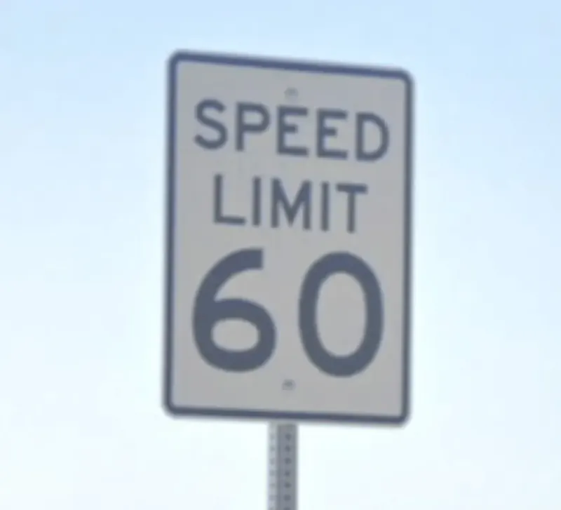
Both countries use the same sign: a white rectangle with a big number. What changes is the word above it. In the USA it says “SPEED LIMIT” and the number is in miles per hour; in Canada it says “MAXIMUM” and the number is in km/h. It is the quickest clue of the lot. Careful with kilometres, though: Interstate 19, between Tucson and the Mexican border, is the only stretch of the USA that gives exits and distances in kilometres.
© Google🇺🇸 United StatesUS speed limit signs read "Speed Limit" followed by the number, while Canadian signs of the same shape read "Maximum" instead. 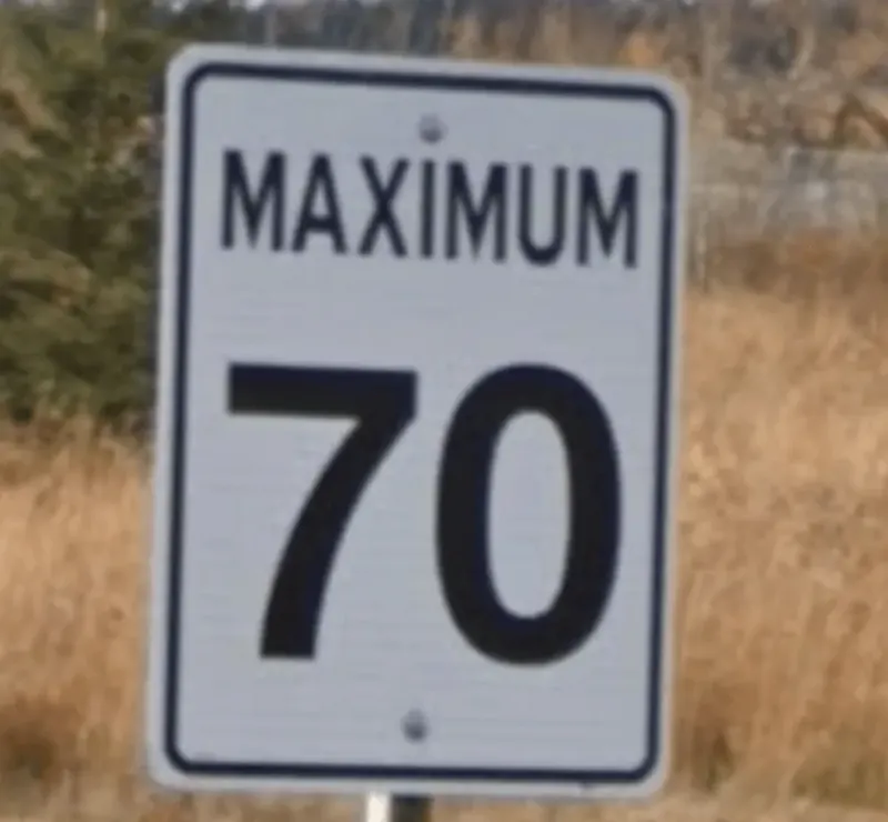 © Google
🇨🇦 CanadaCanadian speed limit signs use the word "MAXIMUM" with km/h, while equivalent U.S. signs say "SPEED LIMIT" with mph, a quick way to tell the two countries apart. 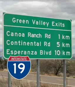 © Google
🇺🇸 United StatesInterstate 19 in Arizona, running from Tucson to the Mexican border, is the only part of the US that uses kilometres instead of miles for highway exit and distance signs, though speed limits there are still posted in mph. -
02
The centre line
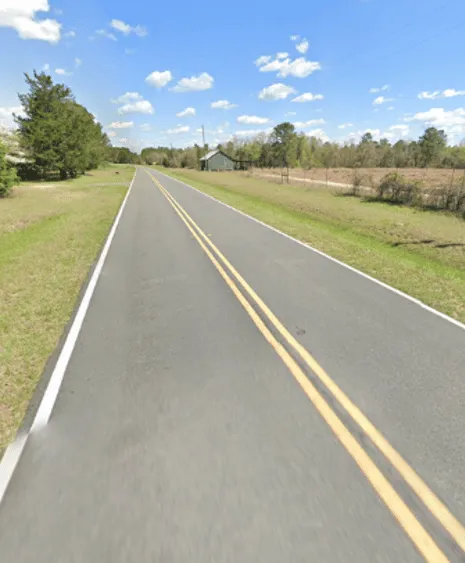
Both countries paint the centre line yellow, but not in the same way. In the USA a double yellow line with white outer lines is the most common pattern; on divided highways the line next to the median is yellow and the rest are white. In Canada a single yellow line is the norm, although double lines are still fairly common. A single line leans Canada and a double one leans USA, but on its own it does not decide: combine it with other clues.
 © Google
🇺🇸 United StatesThe US uses yellow centre lines with white outer lines, and a double yellow middle line is the most common pattern. Double middle lines are less common in Canada, though not rare, so use this meta with caution. 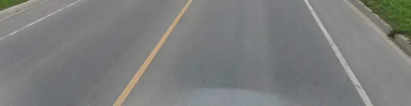 © Google
🇨🇦 CanadaCanadian roads usually have a single yellow centre line, though double yellow centre lines are still fairly common. Double yellow lines are more common in the US, so use this together with other clues. -
03
Signs only one of them uses
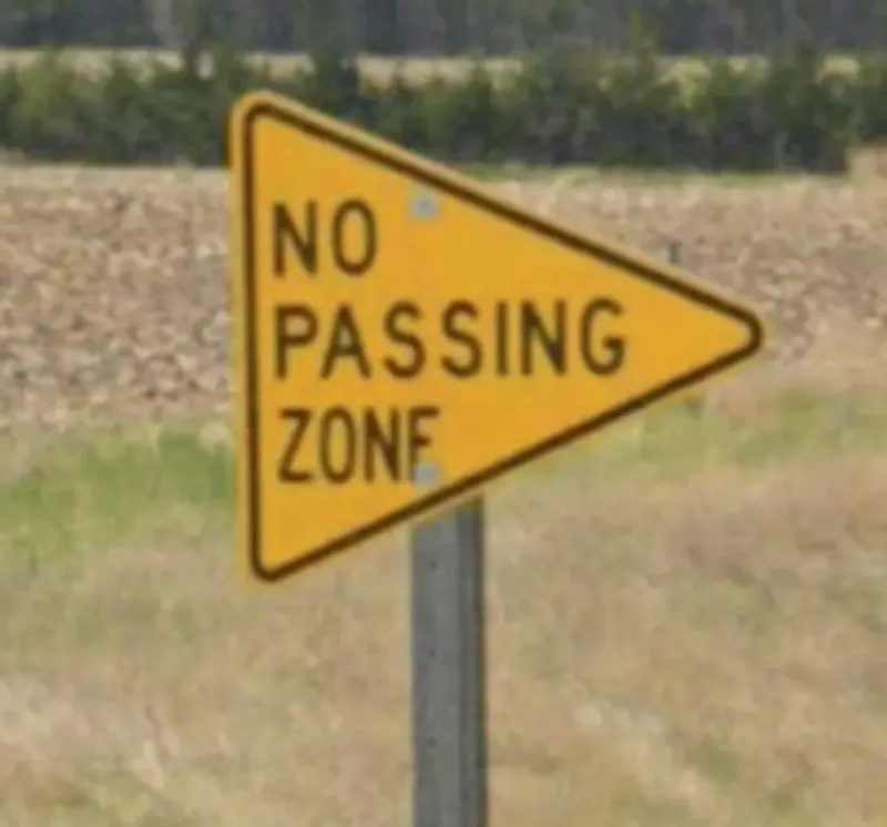
Three signs settle it when they turn up. The yellow diamond with a black checkerboard border and a double-headed arrow, warning of a T-junction, is Canadian and not used anywhere else; some provinces vary the design slightly. The yellow triangular pennant reading “No Passing Zone” is exclusive to the USA. And Adopt-a-Highway signs, thanking whoever sponsors the litter clean-up of a stretch of road, are a distinctly American feature, with a different design in most states.
 © Google
🇺🇸 United StatesYellow triangular signs reading "No Passing Zone" are a US-only design; no other country uses this exact wording and shape. 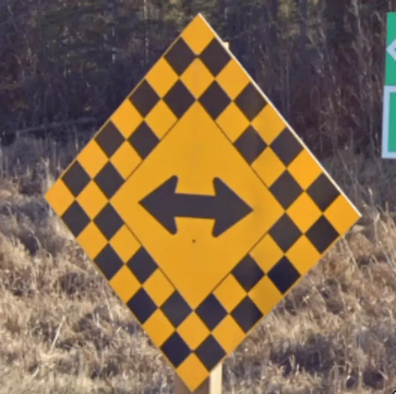 © Google
🇨🇦 CanadaThis yellow-and-black checkerboard diamond, marking a T-intersection with a double-headed arrow, is a distinctively Canadian road sign not used elsewhere. 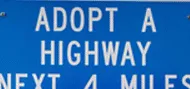 © Google
🇺🇸 United StatesMost US states have unique, distinct, and learnable 'Adopt-a-Highway' sign designs seen on the side of roads, though some states have slight variations in design. -
04
Rumble strips on the edge
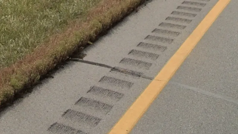
Interstates, US highways and some state roads have rumble strips, small perpendicular grooves cut into the asphalt, along their edges. Canada has them too, but much more rarely. If you see them, lean USA; if you don’t, rule nothing out.
 © Google
🇺🇸 United StatesInterstates, US highways and some state roads have rumble strips (small perpendicular indentations) along each edge; they can also appear in Canada, but much more rarely. -
05
French on the signs
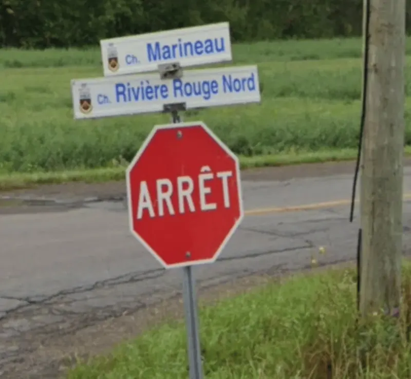
In our cards, French on road signs only shows up on the Canadian side. A stop sign that says only “ARRÊT” is from Quebec, the only province whose stop signs do not say “STOP”. A stop sign with “STOP” above “ARRÊT” is mostly New Brunswick, though it can rarely turn up in other provinces. Bilingual signs are also common in Ottawa and eastern Ontario.
 © Google
🇨🇦 CanadaStop signs showing only the word "Arrêt", with no English "Stop" text at all, are unique to Québec; New Brunswick instead uses bilingual signs with both words. 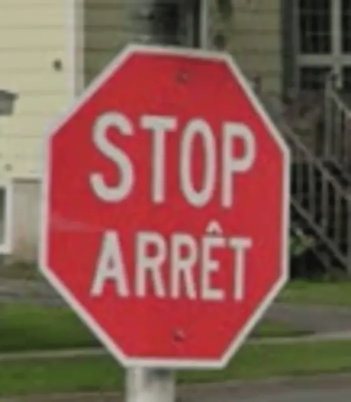 © Google
🇨🇦 CanadaStop signs in New Brunswick always show the English word 'Stop' together with the French 'Arrêt' underneath. Beware that Quebec's stop signs also say 'Arrêt', but without the English word. -
06
Landscape and vegetation
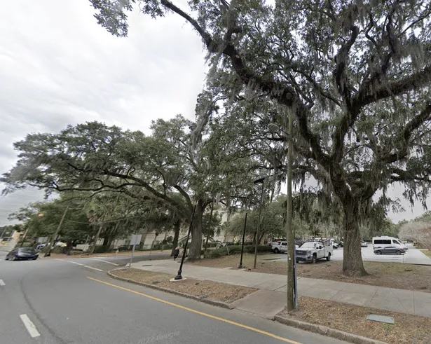
The Canadian Shield covers the eastern half of Canada, so bare rock cut right beside the road through forest is a common sight in Ontario and Quebec. The south works the other way round: Spanish moss hanging from the trees is a Deep South sight, tall southern pines with fluffy needle clusters fill the south-east, and the saguaro is limited to the Sonoran Desert of southern Arizona. Any of them puts you in the USA.
 © Google
🇺🇸 United StatesSpanish moss hangs in greyish-white drapes from tree branches and is a signature sight of the Deep South of the US. 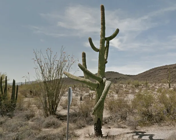 © Google
🇺🇸 United StatesSaguaro cacti grow as tall, straight columns with a few upward-curving arms, and are essentially limited to the Sonoran Desert of southern Arizona in the US. 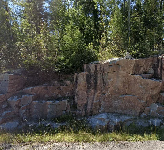 © Google
🇨🇦 CanadaThe Canadian Shield covers the eastern half of the country, so bare rock faces are commonly exposed right next to the road in Street View there.
The hard case: the border, from Maine to Alaska
On both sides of the border the landscape looks very much alike, so there it does not decide: go back to the speed signs, the centre line, each country’s own signs and the French on the Quebec and New Brunswick side. Gen 2 coverage, which generally leans Canada, does not help in Alaska either, which has it right by the border too.
- MaineDense conifer forest along straight highways: it can look a lot like Canada.
- Southern QuebecSouth of the St. Lawrence, Appalachian hills with eastern white pine and broadleaf trees, much like the neighbouring states.
- Great Plains and PrairiesFlat, almost treeless land on both sides; yellow canola fields along the border in North Dakota, and prairie getting drier towards Montana in southern Alberta and Saskatchewan.
- Cascadia and British ColumbiaHuge Douglas firs in Washington and Oregon, but also in British Columbia.
- AlaskaWooden towns under green mountains near British Columbia and the Taylor Highway towards Yukon, both with cloudy Gen 2 coverage.
What does not decide
These clues look the same on both sides of the border, so on their own they do not decide. In MetaSpotter, when a card shows one of them, the other country is never offered as a wrong answer.
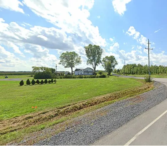 Flat farmland landscape
How to learn them and keep them
Reading this page is not enough: in a week you will have forgotten half of it. These clues stick when you review a few every day, right before you forget them. Start with United States · Beginner (25 cards) and Canada · Metas (25), then mix them with the rest of the region in North America · Identify.
Study North America · IdentifyUSA and Canada decks
More guides
Bollards
The short posts at the edge of the road. Shape, colour and reflector change by country.
Poles
Wood, concrete or metal; holes, ladders and the top of the pole give away the region.
Road lines
Yellow or white centre, edge lines, doubles, dashes: one of the most reliable metas.
Camera car
Camera generation, antennas, mirrors and the colour of the car that shot the coverage.
Clues come from Learnable Meta maps by trausi, Major Bajor, Lireax, Chrort, Vincent Skerved, Stingray. Photos: Google Street View, © Google. Checked by hand by the MetaSpotter team on 19 October 2026. How we make the content